Hobsonville Point Map
Find your way around the Point, and check whether a property is inside the HPRS boundary.
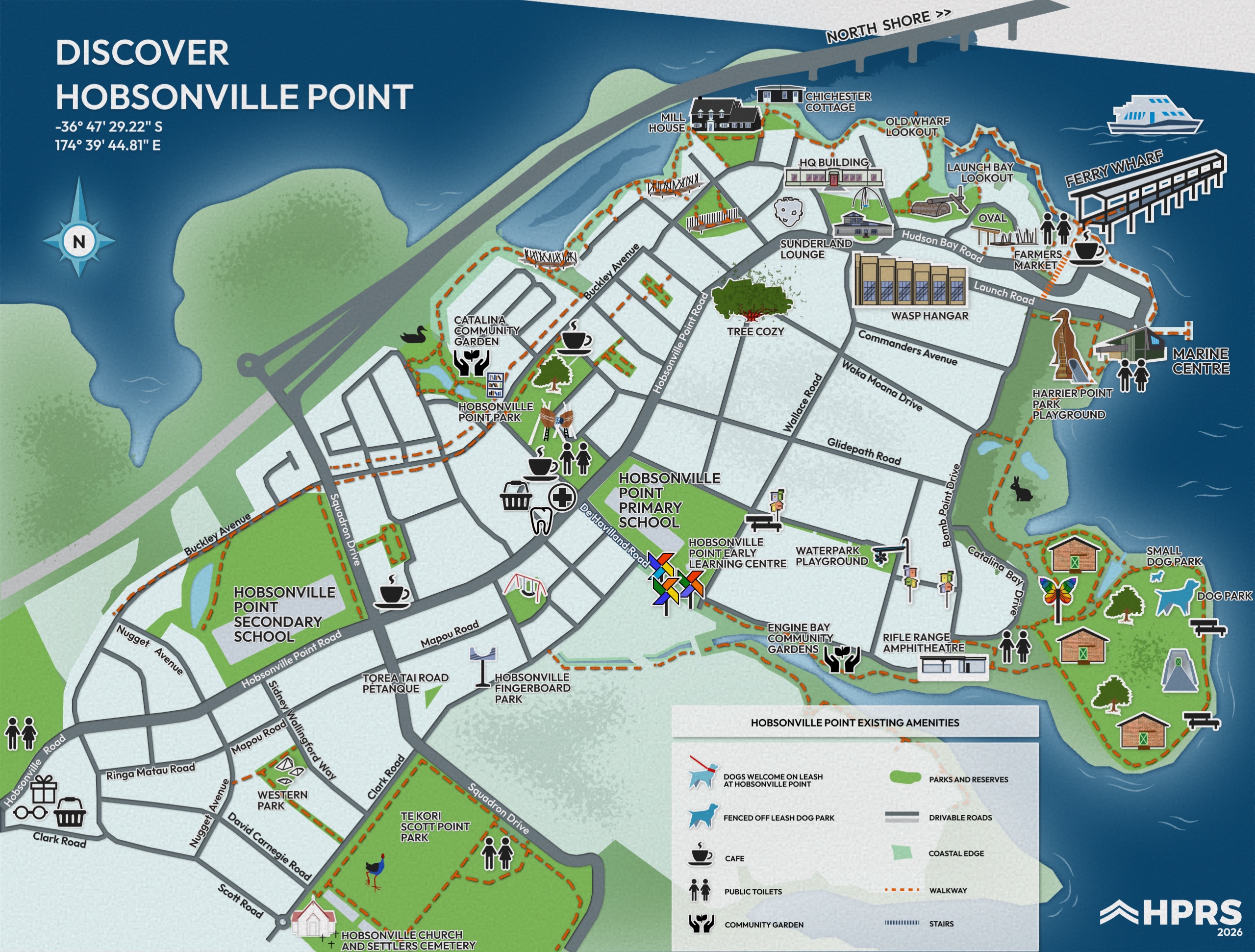
The map of the Point
Parks, walkways, playgrounds, the ferry terminal, schools and community facilities, on the illustrated map. Open it full size to read the labels, or download it to print.
The HPRS boundary
Membership of the Hobsonville Point Residents Society is attached to the property title by an encumbrance, so it applies to every property inside this boundary whether the owner lives there or rents it out. Click a property on the map to check it.
The interactive boundary map needs JavaScript. If you cannot see it,get in touch and we will confirm whether a property is inside the boundary.
Click a property on the map to check whether it is inside the boundary.
The boundary is drawn from the survey the society holds, and the check runs in your browser: nothing you click is sent anywhere. If a property sits right on the line, or the answer is not what you expected, get in touch and we will confirm it properly.